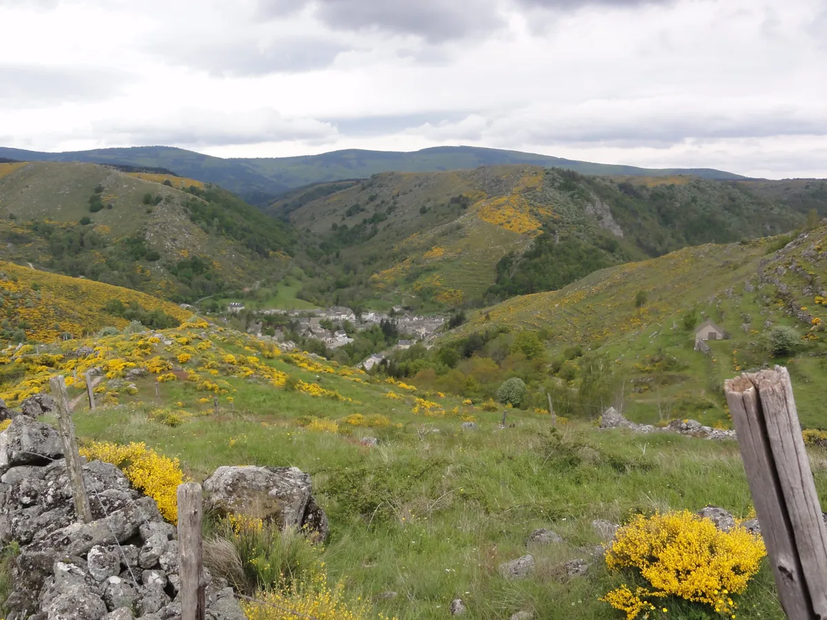
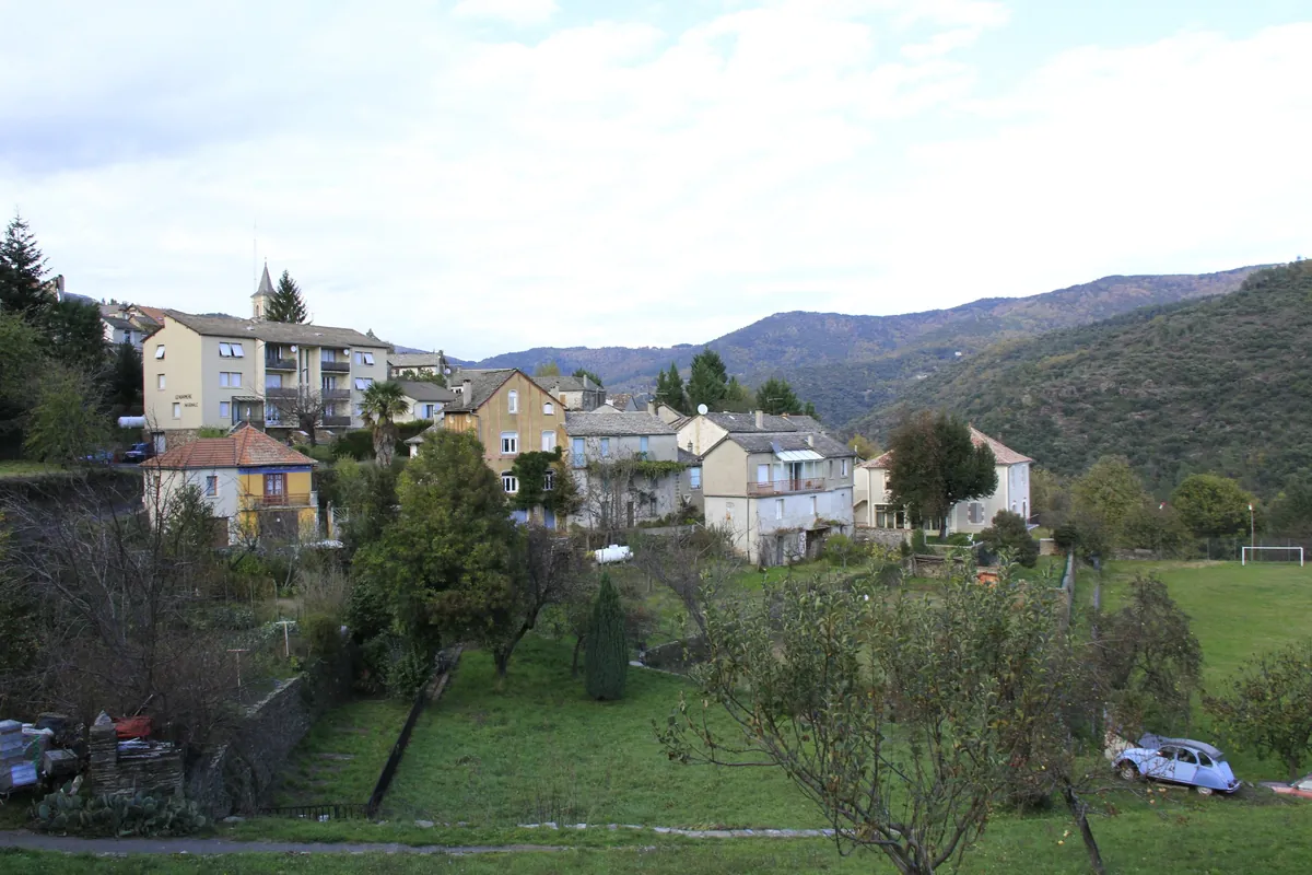
Broom in flower on the hillside above Le Pont-de-Montvert, with the village in the valley and the Bougès ridge behind
Southern half of the 272 km GR70 (Le Puy-en-Velay – Alès)
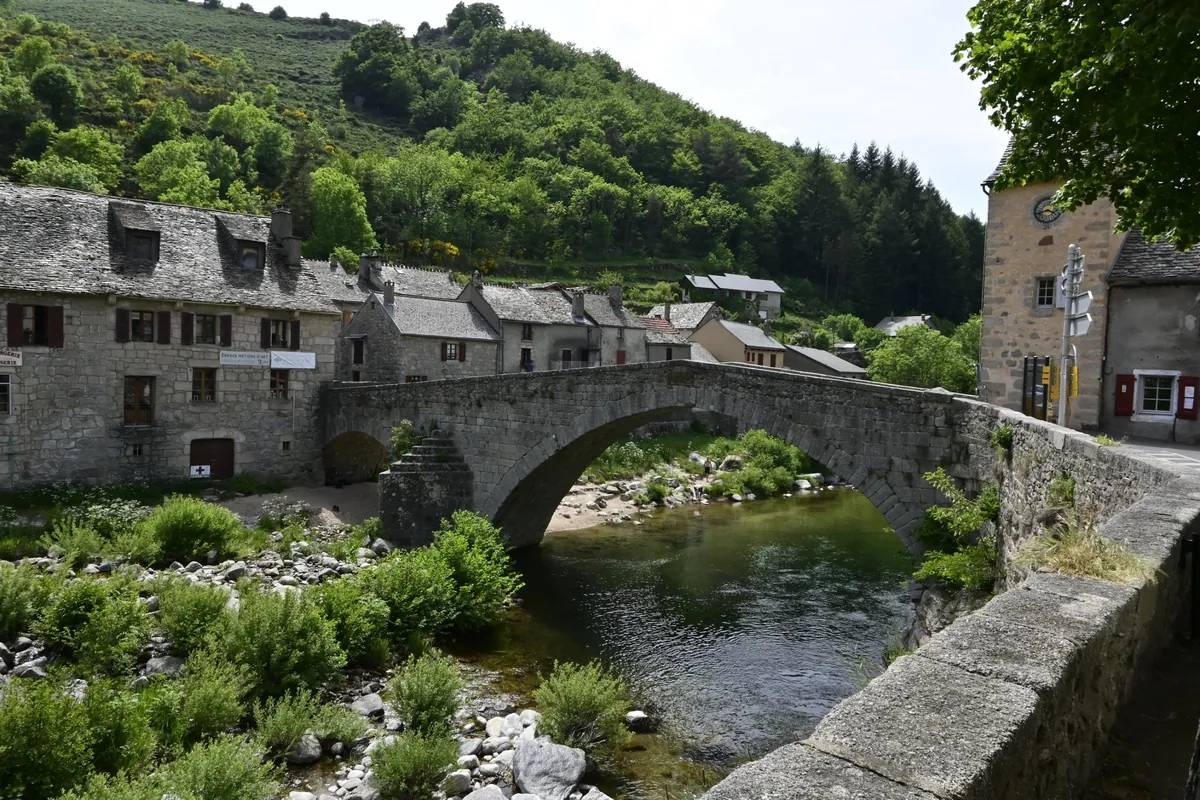
The old stone bridge over the Tarn in Le Pont-de-Montvert, with granite houses and a wooded hillside
France Mont Lozère and the Cévennes Verified campsite to campsite, checked November 2026

Stevenson Trail in 6 days

The southern half of the Stevenson Trail (GR70): over Mont Lozère, across the Bougès and through the chestnut valleys of the Cévennes, with a campsite every night.

Download GPX
Total distance
97.6 km
Walking days
6
Avg per day
16.3 km
Ascent / descent
+3,060 / −3,970 m
Difficulty
Moderate
Best period
May – Sep
Route type
Point to point

Photos: lombiedezombie (Panoramio) / Wikimedia Commons, CC BY 3.0 · Gitarre52 / Wikimedia Commons, CC BY-SA 4.0

Solid line: planned track along OpenStreetMap paths. Dashed: no track yet. Map: OpenFreeMap / OpenStreetMap.

Elevation profile

100 500 900 1300 1700 0 km10 km20 km30 km40 km50 km60 km70 km80 km90 km Day 1 Day 2 Day 3 Day 4 Day 5 Day 6
From 199 m to 1699 m over 97.6 km. Elevation in metres, from the planned track.

Photos from the trail

1 / 6
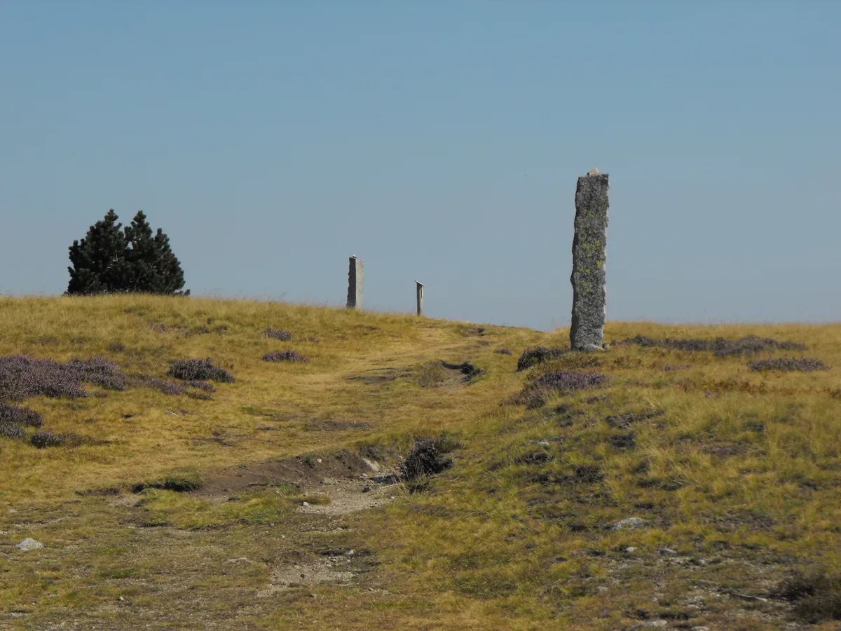
Granite montjoies — standing stones that mark the way — on the bare top of Mont Lozère
Montjoies on Mont Lozère, the waymarks Stevenson followed on day 2 . Photo: Budotradan / Wikimedia Commons, CC BY-SA 3.0
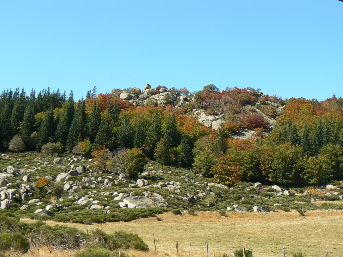
Granite boulders, beech and pine in autumn colours on the slopes of Mont Lozère
Autumn on Mont Lozère . Photo: Ancalagon / Wikimedia Commons, CC BY-SA 3.0
The old stone bridge over the Tarn in Le Pont-de-Montvert, with granite houses and a wooded hillside
The old bridge over the Tarn in Le Pont-de-Montvert, end of day 2 . Photo: Gitarre52 / Wikimedia Commons, CC BY-SA 4.0
Broom in flower on the hillside above Le Pont-de-Montvert, with the village in the valley and the Bougès ridge behind
Broom in flower above Le Pont-de-Montvert — the climb out of the Tarn valley on day 3 . Photo: lombiedezombie (Panoramio) / Wikimedia Commons, CC BY 3.0
Houses of Saint-Germain-de-Calberte on a green slope with Cévennes ridges behind
Saint-Germain-de-Calberte, the end of day 4 . Photo: Isasza / Wikimedia Commons, CC BY-SA 4.0
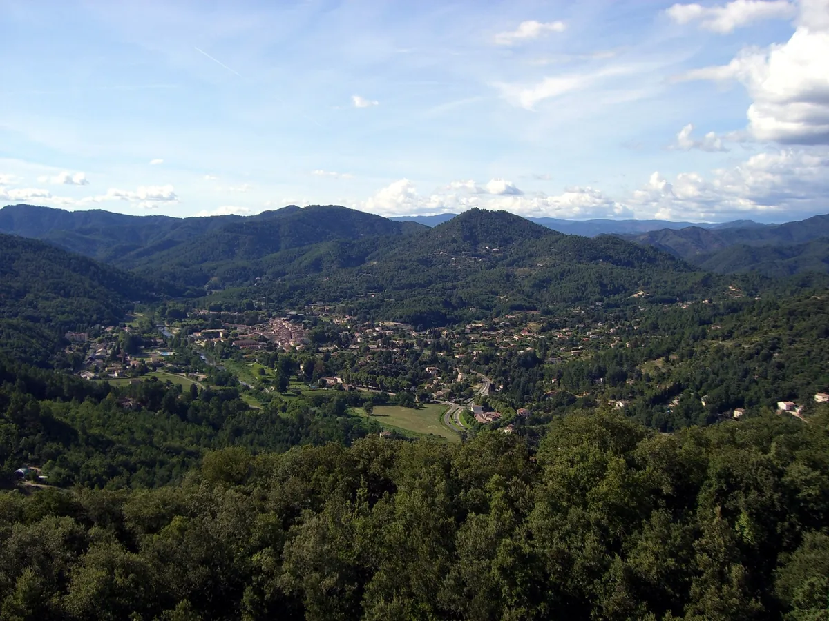
View over the green valley of Saint-Jean-du-Gard and the wooded Cévennes hills
Saint-Jean-du-Gard from above — the finish . Photo: Binnette / Wikimedia Commons, CC BY-SA 3.0

When to go

The top row shows when the trail itself is in good condition (snow, heat, services). Below it, when each campsite is open — the trek works when both line up. Trail conditions can differ from year to year, so always keep an eye on local websites before and during your trek.

When the trail is in condition, opening months per campsite, and when all campsites are open together
Row AprMayJunJulAugSepOct
Trail season Not advisedBestBestPossiblePossibleBestPossible
Campsites open
Le Bleymard PartOpenOpenOpenOpenOpenPart
Le Pont-de-Montvert OpenOpenOpenOpenOpenOpenOpen
Cassagnas OpenOpenOpenOpenOpenOpenPart
Saint-Germain-de-Calberte ClosedOpenOpenOpenOpenOpenClosed
Saint-Étienne-Vallée-Française OpenOpenOpenOpenOpenOpenOpen
Saint-Jean-du-Gard OpenOpenOpenOpenOpenPartClosed
All campsites open ClosedOpenOpenOpenOpenPartClosed

Sources: cicerone.co.uk

Day by day

Day 1 of 6: Chasseradès → Le Bleymard

Distance
18.8 km
Up / down
+570 / −640 m
Walking time
6h 15

Landscape

Over the Montagne du Goulet through pine forest and open heath, past the source of the Lot and down through Les Alpiers to Le Bleymard.

Along the way

The views from the Goulet ridge (about 1,410 m) across to Mont Lozère; the Mirandol railway viaduct near Chasseradès.

Water & groceries

Grocery in Chasseradès before you start. Nothing on the way until Le Bleymard (small supermarket, restaurants). Carry water for the whole day.

Tonight

Camping municipal La Gazelle. The campsite is on the Lot, 200 m from the village.

Day 2 of 6: Le Bleymard → Le Pont-de-Montvert

Distance
20.8 km
Up / down
+690 / −870 m
Walking time
7h 15

Landscape

Up past the Mont Lozère ski station and over the bare granite ridge along the old montjoies (standing stones), across the Sommet de Finiels and down through Finiels to the Tarn.

Along the way

Sommet de Finiels (1,699 m), the highest point of the whole trail; Le Pont-de-Montvert, the granite village where the Camisard revolt started in 1702.

Water & groceries

Café at the Mont Lozère ski station (check its opening days). Shops, bakery and restaurants in Le Pont-de-Montvert. In fog, follow the montjoies — the ridge is very exposed.

Tonight

Camping municipal du Gilliaou. Shady campsite on the Tarn — swim in the river. Shorter option for a long day — Aire naturelle La Barette in Finiels, on the trail about 6 km before Le Pont-de-Montvert (open May – September).

Day 3 of 6: Le Pont-de-Montvert → Cassagnas

Distance
17.5 km
Up / down
+560 / −760 m
Walking time
6h

Landscape

A steep climb out of the Tarn valley onto the Bougès, then the GR72 south over the forested ridge (about 1,250 m) and down through heath and chestnut woods to the Mimente valley.

Along the way

Wide views from the Bougès back to Mont Lozère; the descent into the schist country of the Cévennes.

Water & groceries

No shops or water on the way — fill up in Le Pont-de-Montvert. The campsite at Cassagnas has a restaurant and bread; there is no shop in the village.

Tonight

Camping Espace Stevenson. The campsite is at Cassagnas' old railway station, right on the trail. Only 20 pitches — book ahead in summer.

Day 4 of 6: Cassagnas → Saint-Germain-de-Calberte

Distance
16.2 km
Up / down
+380 / −670 m
Walking time
5h 15

Landscape

Up through the forest to the Plan de Fontmort and along the ridge, then down through chestnut groves and stone hamlets to Saint-Germain-de-Calberte.

Along the way

The Camisard memorial obelisk at the Plan de Fontmort; the Col de la Pierre Plantée.

Water & groceries

No shops on the way. Small shop in Saint-Germain-de-Calberte; grocery at the campsite.

Tonight

Camping La Garde. Quiet campsite with a pool just outside the village; pizza in the evening and breakfast in the morning.

Day 5 of 6: Saint-Germain-de-Calberte → Saint-Étienne-Vallée-Française

Distance
11.6 km
Up / down
+270 / −410 m
Walking time
3h 45

Landscape

Along the hillside above the Gardon valley through chestnut and oak woods, then down to the river at Saint-Étienne-Vallée-Française.

Along the way

A short day with time to swim in the Gardon in the afternoon.

Water & groceries

Shops in Saint-Étienne-Vallée-Française.

Tonight

Éco-camping à la Ferme de la Fare. Small eco-campsite on a donkey farm right on the trail, with farm produce and a swimming spot nearby.

Day 6 of 6: Saint-Étienne-Vallée-Française → Saint-Jean-du-Gard

Distance
12.7 km
Up / down
+590 / −620 m
Walking time
4h 45

Landscape

A last climb to the Col de Saint-Pierre with views over the Cévennes ridges, then the old path down to Saint-Jean-du-Gard.

Along the way

The view from the Col de Saint-Pierre (about 600 m); Saint-Jean-du-Gard, where Stevenson sold his donkey Modestine.

Water & groceries

Nothing between Saint-Étienne and Saint-Jean-du-Gard — carry water, it can be very hot. Supermarkets in Saint-Jean-du-Gard.

Tonight

Camping Les Sources. Family campsite with a pool and restaurant, about 1 km from where the trail enters town (included in today's distance).

Walking times are calculated with the DIN 33466 hiking formula (4 km/h, 300 m/h up, 500 m/h down), without breaks.

About this trek

In 1878 the young Robert Louis Stevenson walked twelve days through the Cévennes with a donkey called Modestine and wrote Travels with a Donkey in the Cévennes. The GR70 follows his route from Le Puy-en-Velay to Alès. This version walks the southern half — the most varied part — from Chasseradès to Saint-Jean-du-Gard, where Stevenson’s own journey ended.

It starts gently on the Montagne du Goulet, crosses the bare granite of Mont Lozère to the trail’s highest point (1,699 m), and then drops into the Cévennes: schist and chestnut woods, deep valleys and stone villages with a story about the Camisards, the Protestant rebels of 1702.

One shortcut. The official stage from Le Pont-de-Montvert to Florac is about 30 km with nowhere to camp in between. This version leaves the GR70 on the Bougès ridge and follows the waymarked GR72 straight down to Cassagnas, where it rejoins the Stevenson Trail. You skip Florac, but every day stays under 21 km.

Why camp to camp here? Wild camping is not allowed along most of the GR70, and most walkers sleep in gîtes. Yet there is a regular campsite at every stop on this half of the trail, several of them used to hikers with a tent.

Before you go. Days 1 to 3 cross open, high ground with few shops: carry food for a day and water for the whole stage. Cassagnas and Saint-Germain-de-Calberte have the smallest campsites — book ahead in July and August.

Campsite to Campsite check

Automatic check of our eight conditions.

  • Every night at a regular campsite that accepts tents
  • Every campsite reachable on foot from the route
  • Each stage starts where yesterday ended — at most a short transfer of 30 minutes, always shown
  • No wild camping or bivouacs needed
  • No huts, hotels or hostels as standard overnight
  • All campsites open during the stated season
  • Daily distance and ascent measured and checked
  • Walkable with a full trekking pack

GPX downloads

Works with Garmin, Komoot, OsmAnd and other apps.

Questions about Stevenson Trail in 6 days

Do I need to book the campsites in advance?

Booking is recommended in high season (July and August) at Camping Espace Stevenson in Cassagnas, Camping La Garde in Saint-Germain-de-Calberte and Camping Les Sources in Saint-Jean-du-Gard. For the other 3, check with the campsite before you go.

When is the best time to walk Stevenson Trail?

The best months on the trail are May to June and September. All campsites on the route are open together from 1 May – 27 Sep. Mont Lozère is exposed — expect wind, fog or snow until May and from late October. July and August are hot in the lower Cévennes valleys; start early.

How difficult is Stevenson Trail?

It is a moderate trek of 97.6 km over 6 days, about 16.3 km a day with 3,060 m of ascent in total. The longest day is day 2 (20.8 km, 7h 15); the most climbing is on day 2 (690 m up). Walking times are without breaks and you carry your full camping gear, so plan on a little longer.

Do I need a bus or taxi between the stages?

No. Every day starts at the campsite where you slept the night before, and every campsite can be reached on foot from the trail.

How do I get to the start by public transport?

Train to Chasseradès on the line Mende – La Bastide-Puylaurent (La Bastide is on the Clermont-Ferrand – Nîmes line). The campsite is about 20 minutes' walk from the station. Getting home: From Saint-Jean-du-Gard, buses run to Alès and Nîmes, both with trains to the rest of France.

How much do the campsites cost?

Between €10 and €25.50 per night for one hiker with a small tent (at 4 of the 6 campsites we have a price). Prices are indications; tourist tax and showers can be extra.

Can I buy food along the way?

5 of the 6 campsites have a shop or restaurant on site. The day-by-day section lists water points and shops for every stage.

Is there a GPX track for this route?

Yes. You can download the whole route and each day as a separate GPX file. They work with Garmin, Komoot, OsmAnd and most other hiking apps.

Walked it recently?

Report a closed campsite, a detour or a new water point. Every report is checked before the route changes.

Report an update

Stevenson Trail in 6 days